
LoD3 Road Space Models
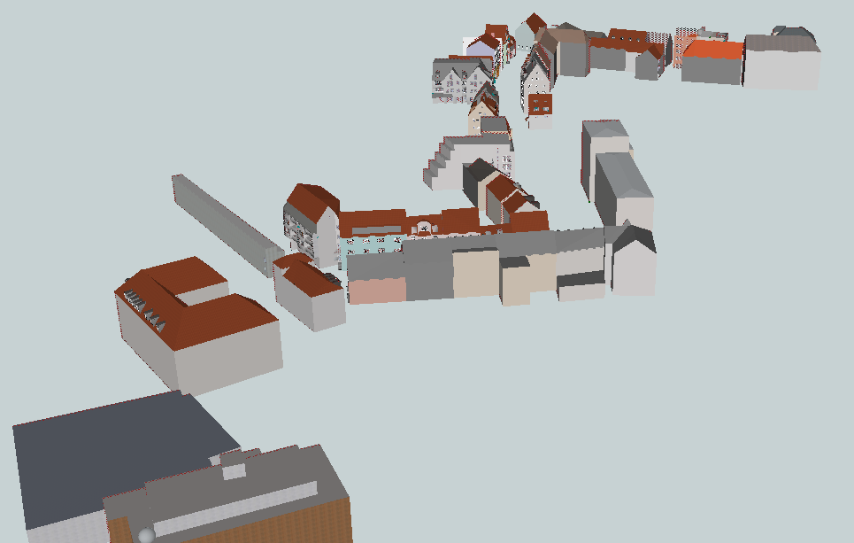
LoD3 (Level of Detail 3) Road Space Models is CityGML dataset which contains road space models (over 50 building models) in the area of Ingolstadt.
There are several approaches to model Building in CityGML 2.0 (e.g. see Biljecki et al.). In our case, due to the acquisition geometry of MLS point clouds, the building objects consist of a very detailed representation of facade elements but on the other hand, it might lack roof elements and entities located in the Building's backyard. Thus, we encourage to see the list below for a detailed description of the Building in our Ingolstadt LoD3 dataset:
The building consists of:
- Ground Surfaces
- Roof Surfaces
- Wall Surfaces
- Outer Ceiling Surfaces
- Outer Floor Surfaces
- Closure Surfaces
- Windows modeled in detail
- Doors modeled in detail
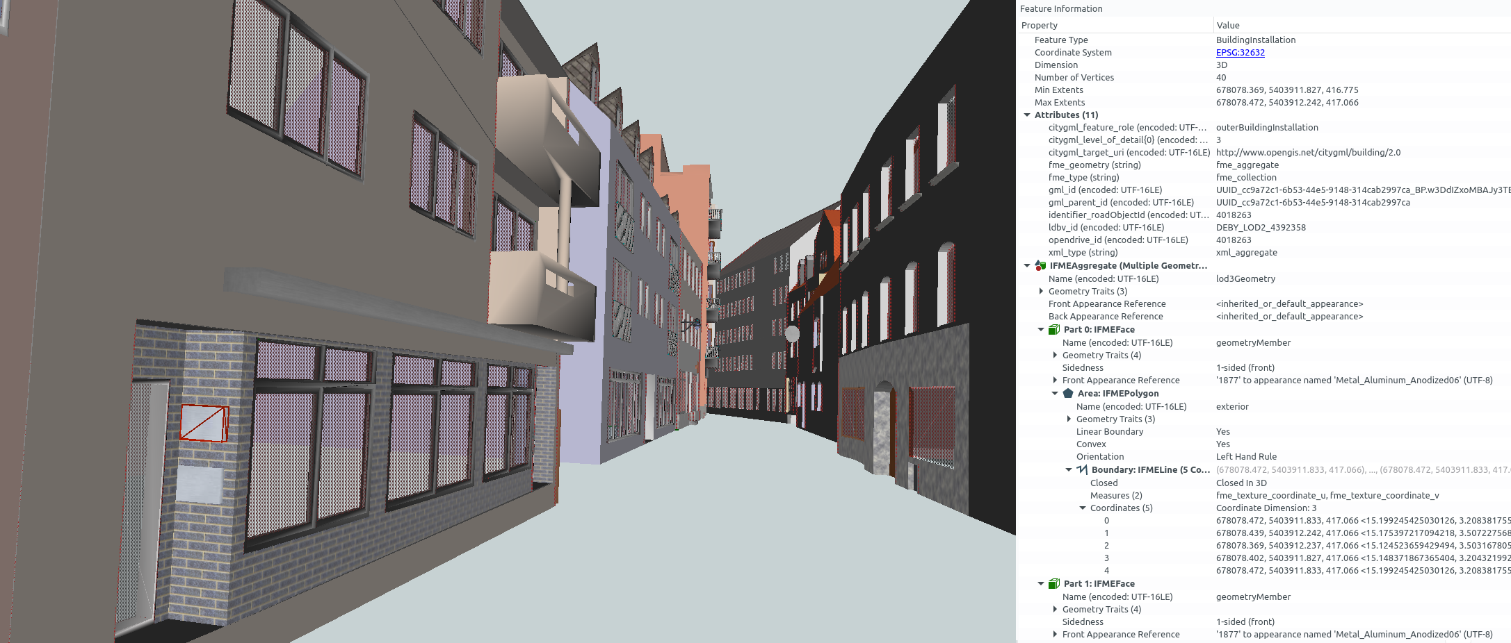
- Building Installations (Balconies, Passages, Arcades, Loggias, Stairs and Porches, (Some) Dormers)
- Textures (approximated based on visual inspection)
Building does NOT consist of:
- Overhanging Building Elements
- Roof structure details
- Objects located in the Building's backyard (not facing the street)
- Building Installations (Chimneys, Rain Gutters, (Some) Dormers, Real (e.g. orthophoto) textures)
The terminology according to SIG3D.
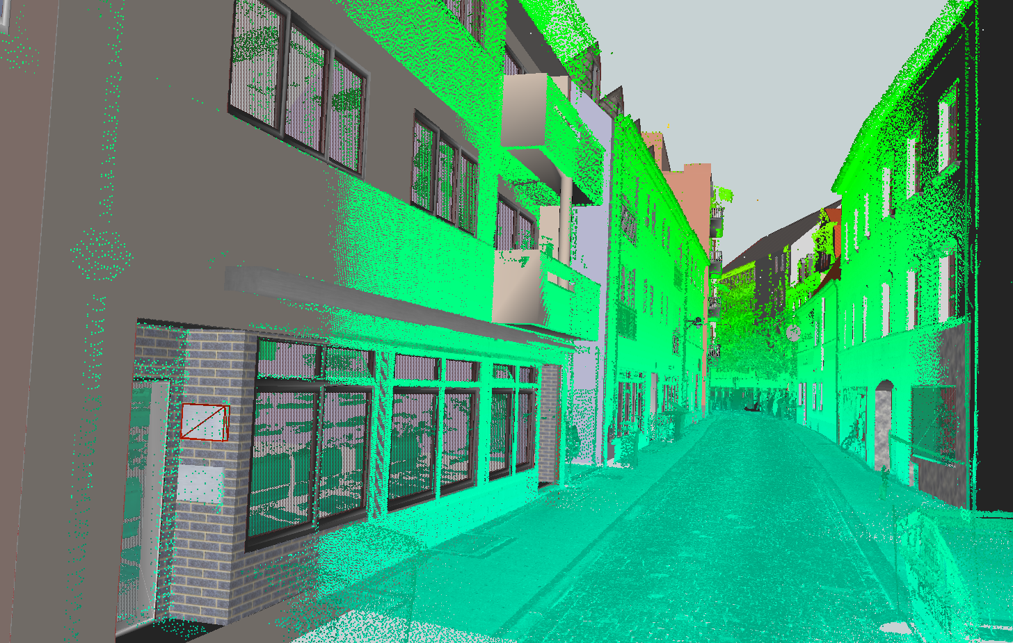
To ensure the highest accuracy geometrically as well as semantically, the dataset was manually modeled based on the mobile laser scannings (MLS) provided by the company 3D Mapping Solutions GmbH (relative accuracy in the range of 1-3cm). Moreover, a complementary OpenDRIVE dataset is available, which includes the road network, traffic lights, fences, vegetation and so on:
- CityGML & SketchUp
- Download via the releases section
- Please note, that the 'Download ZIP' button doesn't include the project files due to Git LFS
- OpenDRIVE
- Download via the website of 3D Mapping Solutions (initial registration required)
- Relevant OpenDRIVE dataset is named *Ingolstadt Innercity Halls* and can be found in the demo data area
- Conversion to CityGML can be carried out using the tool r:trån
Further Information:
- Overview: Web-Map-Client (LoD3 models combined with converted OpenDRIVE dataset)
- Creation guideline: Creating LoD3 Models Based on Point Clouds
- License:(CC BY-SA 4.0)
Daten und Ressourcen
-
Link zum DatensatzCityGML
LoD3 Road Space Models
Dieser Katalogeintrag ist explizit mit anderen verbunden. Um weitere Informationen zu erhalten, gehen Sie bitte auf "Verknüpfungen" (auf den Link oder auf Register "Verknüpfungen" oberhalb der Überschrift des Katalogeintrages klicken).
Zusätzliche Informationen
| Feld | Wert |
|---|---|
| Autor |
|
| Verantwortlicher |
|
| Sprache | English |
| Version | 0.8.1 |
| Start des Gültigkeitszeitraumes | |
| Ende des Gültigkeitszeitraumes | |
| Räumliche Ausdehnung |
Räumliche AusdehnungMap data © OpenStreetMap contributors
Tiles by Stamen Design (CC BY 3.0)
|
| spatial | {"type":"MultiPolygon","coordinates":[[[[11.42061,48.763535],[11.419322,48.758273],[11.425974,48.757679],[11.428463,48.761074],[11.422284,48.763365],[11.421726,48.763846],[11.42061,48.763535]]]]} |
| Benutzerdefiniertes Feld |